


Introduction
I first came across the backpacking possibilities on the coast after my cousin gave me Backpacking Washington: Overnight and Multi-Day Routes by Craig Romano. I had been out to the Olympic National Park to backpack before—we ventured to the Enchanted Valley—but had not considered backpacking on the beach.
There were a couple of things that stood out to me:
- It's accessible year-round
- Plenty of reservations were available through recreation.gov
- I had never backpacked on the coast
- The Ozette Triangle is a relatively flat and short trail
Therefore, I booked a one-night trip, starting at the Ozette Loop Trailhead, planning to travel clockwise on the triangle, and camp at Cape Alava before hiking out!
We ended up having relatively good weather, which was the opposite of what was forecast for the weekend, found a great camp for the night, and everything went as planned!
The biggest downside is that it takes 4 hours, from Kent, WA, to drive out to Ozette. I saw Lake Crescent for—possibly—the first time, but the drive was a bit of a commitment for one night. Regardless, we had a great time, and I would recommend it.
Overview
One night (Apr. 24-25, 2021)
Total Mileage: ~10 miles
Weather: https://forecast.weather.gov/MapClick.php?lat=48.15340000000003&lon=-124.66565999999995#.YHODfhNKhpw
Entry Trailhead: Ozette Triangle Loop Trail
Exit Trailhead: Ozette Triangle Loop Trail
Permits/Fees:
- Wilderness Permit through Recreation.gov
- Olympic National Park Pass, America the Beautiful Pass, or daily parking fee that you can pay at the trailhead. I did not have to use the daily fee, so I'm not sure what the fee is.
Camp: Cape Alava
NPS - Ozette Loop - Plan Your Visit This linked site is probably the best resource for preparing for this hike.
Day 1
Destination:
The map below is a screenshot of the route from Day 1. The total mileage is an aggregate of all the walking I did that day. This included side excursions at Sand Point and Wedding Rocks. The trail mileage is approximately 6 miles.
The Trail
There were two things that we knew going into this hike in regards to the trail.
- It's pretty flat
- There are slippery boardwalks
I'm happy to say that no one slipped on the boardwalks, but some sections were in pretty bad shape. Boards were out, and some parts were wobbly. An extensive section of the trail between the trailhead and Sand Point (the bottom point of the triangle) uses boardwalks.
A typical section may look like the image below.
However, work is being done to fix problem sections.
It still had that new wood smell as we walked on it in the rain! The first three miles of the triangle took us only one hour to complete before arriving at Sand Point.
Sand Point has a wonderful beach. The tide was out, so we got the best of both worlds: tidepools and a sandy beach.
We didn't check out the camps here. The water source seemed closer than I imagined it to be on the map (if you planned on camping here). Also, Sand Point does not allow campfires on the beach. This was one reason I decided to travel clockwise around the triangle, staying at Cape Alava and not counterclockwise staying at Sand Point.
This is the first place that we saw bald eagles! By the end of the trip, they seemed commonplace.
We dropped our packs and walked around during a drizzle to explore the large rocks and coast. There were a surprising amount of day hikers and an equally surprising amount of buoys and other trash washed up on the beach.
We didn't know at the time, but the compacted sand beach that was so nice to walk on would be gone soon.
Tidal Obstacles
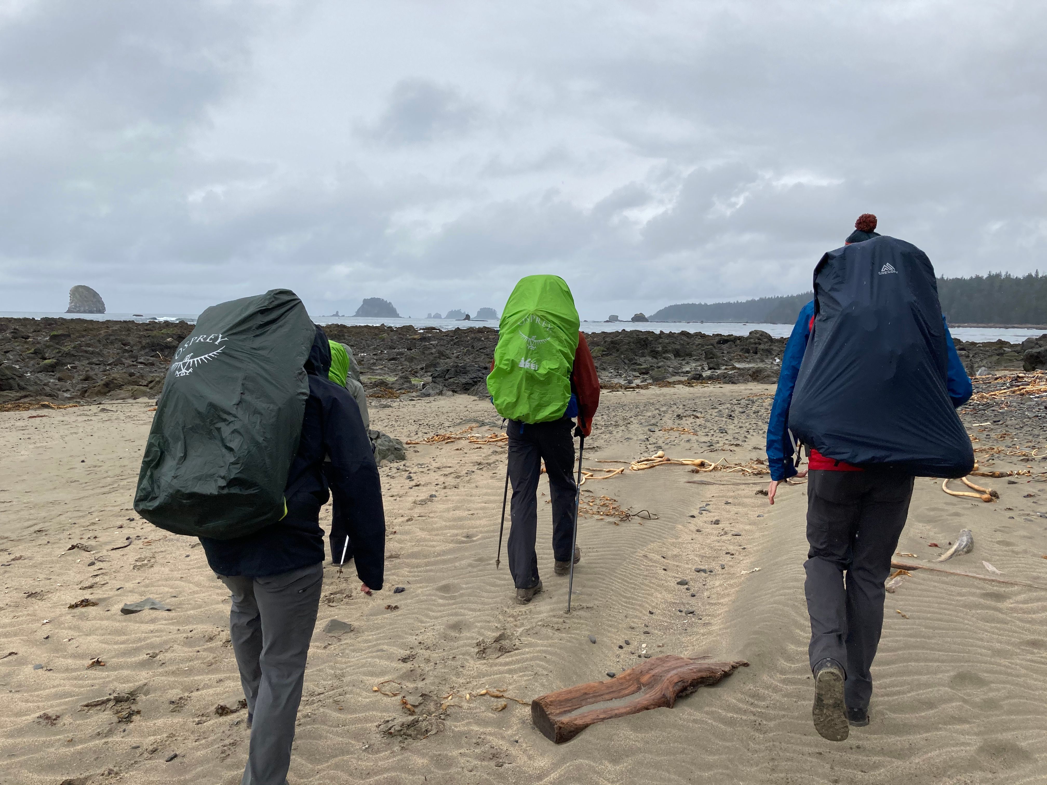
As we began the second 3-mile section of the trail, hiking north from Sand Point to Cape Alava, the sandy beach gave way to a rocky shore, and we found ourselves walking in soft sand. It was inconvenient, but with such a short distance, we didn't gripe too much.
We came across the first of two tidal obstacles 0.9 miles north of Sand Point.
I read in another blog (so double-check this information) that the tide needs to be below 5.5 ft to pass by the beach here. There is an on-shore overland trail. But, if you inspect the image above, the overland trail is that very steep shoot going straight up the hill on the right side of the image.
There is a rope that can help wayward backpackers over this obstacle, but ONP does not maintain it.
The tides are no joke on the coast. They should be taken seriously. It's recommended to carry a tides map and to plan accordingly.
A good resource for learning more about coastal backpacking is this site on NPS.
Therefore, we were happy to see the tide going further out as we hiked!
Wedding Rocks
We reached Wedding Rocks after about 2 hours and 45 minutes of hiking and exploring. This area is approximately five miles from the trailhead, traveling clockwise. Additionally, it is a highlight of the trail because of the petroglyphs carved into the area's rocks.
Wedding Rocks is the second tidal obstacle on this route. Again, this information is not verified, but the tide needs to be below 5 ft to pass this area using the beach.
Fortunately, the overland trail is not as intense as the one we saw for the first obstacle.
We stopped at Wedding Rocks to have a few snacks, enjoy the unexpectedly nice weather, and look for more petroglyphs.
It isn't easy to find information on the petroglyphs at Wedding Rocks. I read somewhere that they are believed to be 100-500 years old and created by members of the Makah tribe (in my search for history, I came across a recent vandalization incident that I remember seeing when we were there).
Wedding Rocks is also a potential camping area with camping spots (from what I remember) North of the point.
I'll post more photos of petroglyphs in the gallery at the end.
Cape Alava
I read on Wikipedia that:
Cape Alava is the westernmost point in the contiguous United States, with a longitude of 124° 44′ 11.8″ W (during low tide and walking out to the west side of Tskawahyah Island).
When I received my permit, via email, from ONP through Recreation.gov, they provided a nice outline of the Cape Alava camp area.
Credit: Olympic National Park Service
Currently, because of COVID, all beach hiking north of Cape Alava is closed.
The number of groups made it seem like there were more sites than you could count on the map. We found a great spot that was close to the second outhouse (but not too close).
There were more trees than I anticipated, but the spots remain exposed to wind and rain. Thankfully, we didn't have either!
We did, however, have plenty of deer. The deer aren't the only animals in the area. Bear canisters are required in the camp, but because of the sneaky raccoons, not the bears. Also, more than a few herons and bald eagles frequent the area out in the tide and sea stacks. Rounding out the animal kingdom at Cape Alava is the seals, which we couldn't see but could hear barking at night and in the morning.
Water Source
The NPS website and Recreation.gov warn about the color of the water (even after it is filtered). It retains a brownish/yellow color that makes it appear unfit to consume. However, the discoloration is harmless (granted, the water is filtered or boiled).
Beach Fires
Fires are allowed on the beach at Cape Alava below the high tide line. Campers can collect and burn driftwood, which is scarce around the camping area. My cousins were ahead of the game and found some dry pieces of cedar along our beach walk that served as good kindling. This helped us burn some of the few damp pieces of driftwood we were able to find.
We didn't see a ranger, but they would have had their work cut out for them.
Someone had a dog that took off down the beach at one point, and the same person was scavenging wood off a live tree (or so it seemed).
Others had made their fires in camp, where previous groups had ignored the guidelines for the campfires.
The rules often change, so make sure you take a look at your permit or review the guidelines online before heading out there.
We created a nice little fire that the neighbors camping next to us inherited after we went to bed.
Credit: Brent Lang
We didn't have any trouble with raccoons, rain, or wind. It was an enjoyable night (to our surprise!).
Day 2
Destination:
We woke up to a slightly chilly morning, but no rain or wind. The sun wasn't quite out, and a lone seal was barking.
The Trail
The trail out from Cape Alava to the trailhead seems identical to the trail from Sand Point to the trailhead.
There are boardwalks, some swampy areas, large trees, and it's relatively flat. Fortunately, this was the only time we had to deal with a lot of rain. The last mile was pretty wet, but that was fine in comparison to our expectations.
We all agreed that having the 3-mile section out and not the 6-mile stretch we did the previous day was good planning. And, it worked well with the tide.
In closing, it was a nice April backpacking trip. With how busy this area can get in the summer (so I have heard), we timed it well and were lucky enough to have decent weather.
Gallery
Includes pictures by Brent Lang, Jesse Lang, Chase Pierson, and Jarrett Retz.