


Introduction
With my recent move back to the desert (La Quinta, CA) I wanted to chronicle a series of hikes where I provide the information that I sought out before the hike, or discovered later, because this information was what I needed to know.
I'm 25, in decent shape, usually hike alone (not always by preference), and like to plan a decent amount. If that's relatable, I suggest continuing. The hikes I'm choosing are for slightly more experienced hikers with sometimes a little travel time, sometimes a lot of travel time.
When I talk about weather, finding trails, or trail stats these are the apps where I get that information from.
- I find hikes mostly using the AllTrails app.
- I use Maps 3D when I'm actually on the hike (love it)
- I use NOAA Radar for weather
If you are interested in other hikes that can be reached from the Coachella Valley, below are some small posts, that may or may not be useful from last winter (some might just be a picture actually)
- Bear Creek Oasis
- Bogert Trail to Murray Hill
- West Fork Trail – Indian Canyons
- Palm Springs Aerial Tramway
- Eisenhower Mountain
- Art Smith Trail
- Joshua Tree
- Bump & Grind
- Painted Canyon Trail
Quick Stats
- Total Time: This excursion took ≈6 hours
- Date: November 18
- Driving Distance: ≈47 miles
- Hike: 6.63 miles, desc./asc. ≈2,265 ft., 4 hours, trailhead elevation 530 ft
- Expenses: Food, Gas
This hike had character. At times it was entertaining, frustrating, surprising, exhausting, dangerous, or heartwarming. I didn't expect the slot canyons, puzzling scrambles, or hikers journal at the top. However, that's a good place to start, what I expected.
On AllTrails the hike is shown to be a 2.23 mile hike that gains 1,600 ft in elevation. A review or two warns about the scrambling, route-finding, and loose rocks. After looking at the map, on AllTrails and Maps 3D, the road to the starting spot seemed strange. It's a jeep road that most cars can't access (it's pretty gnarly in some places), so I would have to walk in from off of Borrego Salton Seaway.
I had all morning (leaving La Quinta at 5:30 A.M.) and the weather was great with hardly any wind.
Destination:
Getting There
I left early, taking SR-86 South along the West side of the Salton Sea. It was a nice morning and I got to watch the sun start it's rise behind some clouds. So, it's strange going out that way because the Salton Sea is a weird place. Not only is it a desert landscape, but there's many decrepit, abandoned buildings.
Something I like about going out there are the dusty/smokey looking mountains that guard the Coachella Valley. I think about Jack Kerouac, and how his book, The Dharma Bums, describes the main character jumping trains through that area down to Mexicali and Calexico.
It's about 40 miles into the drive, down SR-86, when I came to the Borrego Salton Seaway turn, and at that turn there is gas and opportunities to grab food if needed. After I turned onto that road, there's a housing development with scattered homes, dirt yards, that look like people didn't want to build houses too close to the other people's houses. The road is bumpy with weird maintenance patches going past the development area. Capping it off are the telephone poles and wires. It feels like this is where the world ends.
Thankfully, that part ends, and I was surprised to come across a lot of campers! There primitive camping out along the highway, because of all the ATV and OHV recreational areas. It turns into a cool area with many arroyos and places to pull off and camp.
(I hope to make it back out here for some stargazing and a little more hiking later in the winter actually, but more towards highway 78.)
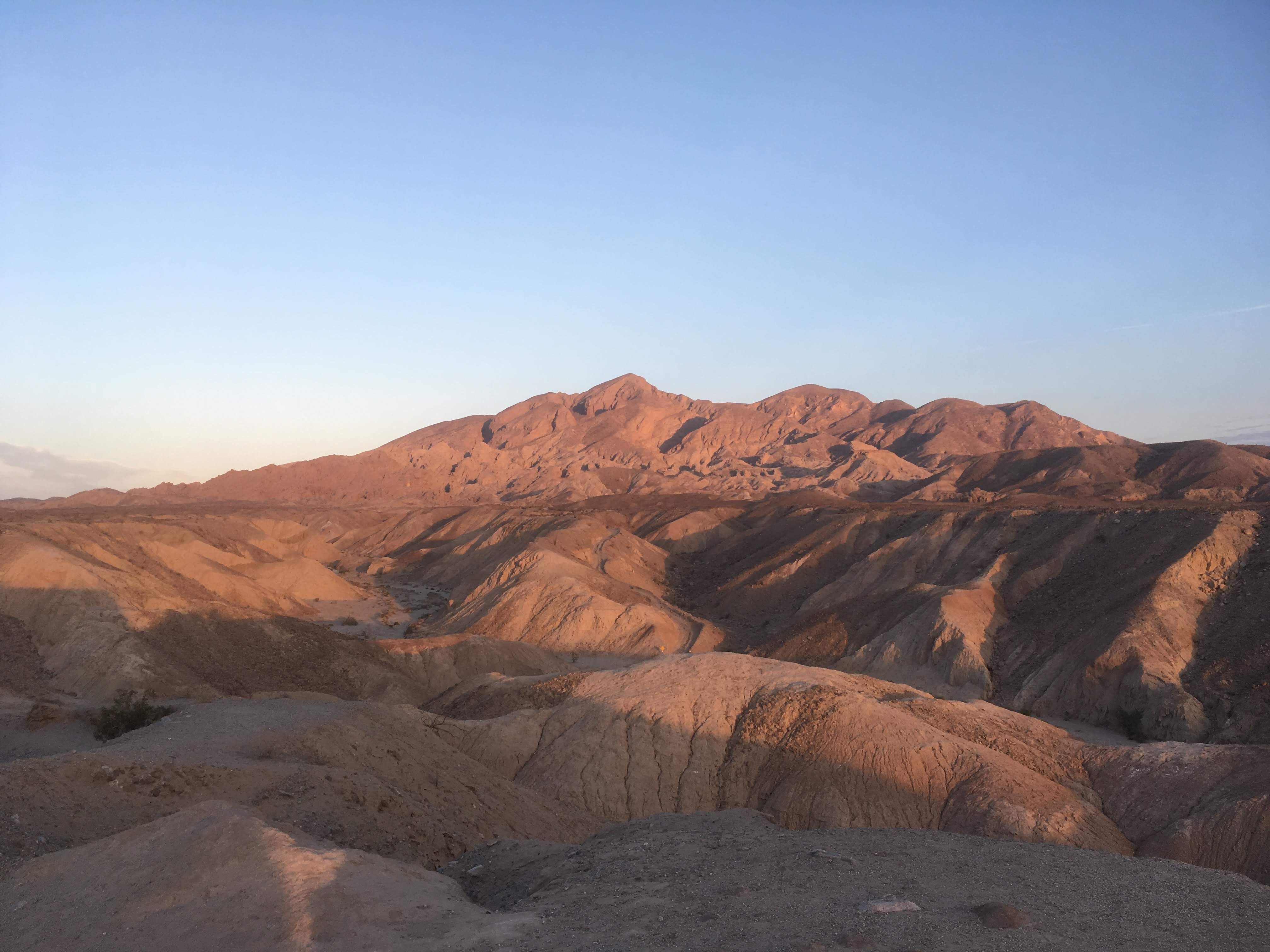
As the road gained elevation there were some places to pull off and look over the desert. So I did.
I didn't realize there was a slot canyon until I found out the trailhead I was going to was called 'Calcite Mine Slot Canyon Trailhead'. I actually drove past the turn off the first time because it's a pretty small parking area. It's called Calcite Rd on some maps, and on Google Maps it shows up at Calcite Mine Slot Canyon Trailhead.
It took me an hour to reach the trailhead and it was so quiet when I got out there. It was one of the quietest places I have ever been I think. It was great.
The Hike
I started hiking along the jeep road. It was fairly easy hiking, and it was a cool morning so I had my Patagonia shell on. The terrain started to get steep on the road and I came across the Calcite Slot Canyon hike on my right.
I would eventually hike down through that section on my way back. This whole area is amazing for exploring, with many side canyons and arroyos, and reminds me of the Mecca Hills Wilderness.
I soon came across a trail junction and I left the jeep road (by accident). To talk about different sections of the trail better I made this image. The points are numbered in the order that I will talk about them.
1, is where the jeep trail drops down and intersects the canyon. This is where I went left. The trail got really cool here. I took some video and pictures of this section. The first image will be of the trail junction.
After I worked through the slot canyon I had to make my way back to the jeep road and the start of Traveler's Peak hike as designated by AllTrails. I accidentally missed the turn, but there was a couple of large rocks, just a few more seconds down the trail, that negated my continuation and signaled me of my mistake. Below is a picture of where the trail turns out of the small canyon & heads back to the jeep trail.
At this point, I was sweating pretty good, and actually considered that possibility that I didn't bring enough water (I brought 56 oz. which ended up being O.K). This is where the real hike began (3).
The next part of the trail is categorized by steep inclines, no shade, a very light trail to follow, and I ended up losing the ill-defined trail and just finding a route on my own. It's pretty much climb up incline in front of you, see next one, climb up that one, look for other possible route, then climb up that too. The section I am referring to is between points 3 and 4.
Coming back down this section of the trail was pretty cool. You might be able to see how the elevation changes in the map. There's a wash to your right, and steep ledges to the left as you hike up this ridge. I took the picture below as I made my way back down to try and show this section.
Now we get to point 4. Wow, did I have a lot to say about this part in the hike, but I worked it out on the way down so hopefully I don't ramble. If I were to do this hike again I would be hard-pressed to not try to see if I could bypass the section between 3-4 (hiking up the wash) and then cut up after point 4. At 4 the trail is a little difficult to find, and it gets really steep. It seems ridiculous to try and scale this section when it can be bypassed on the right. So, that's exactly what I did. To give you an idea, here's a picture of two different options.
Coming back down, I found the trail on the left and thought "Oh, ok I get it. It's not as crazy as it looked." However, I went on the right. I lost elevation (and there's something to be said about losing elevation when you don't necessarily have to) but what I was doing this high on the ridge in the first place? The hill before this one, there is a large ascent then descent, so going up this one seemed more crazy when, peaking around to the right, you can see there's no physical barrier from meeting back up with the trail if you traverse the North side of this node.
So there's my rant. Maybe this trail is more difficult than it needs to be. Taking the arrow on the right there isn't a trail, and I was doing some scrambling, but it seemed like less of a risk than scaling the side on the left.
After this section the trail seemed fairly casual and enjoyable. I had about 50 conversations in my head (all in regards to point 4) that I hardly noticed how quickly I was approaching the summit. Soon enough, I was there!
If I had done a little more research I might have discovered what would be at the top, and why perhaps the peak is called Traveler's Peak. In the rock pile by my backpack, there is a small red can, and inside the can...
"The oldest entry I could find. Almost 40 years ago!"
There were a couple of books inside bags as a hikers registry. Lots of old entries from the 90s, 2000s, and the oldest one is dated 1979.
It was nice day. Many entries noted windy conditions, but for me, the sun had gone behind some clouds and the wind was quiet. It had taken me 2 hours to reach the peak. I had hiked 3.47 miles and climbed 2,100 ft.
On the way back down the trail was easier to find, as it often is, and I took in the sights a little bit more.
On my way back down I made another side trip off the jeep road into the trail I had seen earlier. It is marked in the image as section 5. This route also allotted more shade than walking along the jeep trail.
This hike had some grueling aspects to it, but many of those made it worth it in the end. I didn't see another person the whole time until I was a half mile to my car on the way back and a 4-runner went cruising by. Quite a fun hike, and really cool area, even if you are just checking out the canyon hikes (which are much less strenuous).
A few more things...
There were a few things I was really thankful I had on the hike with me (more thankful than I usually am on a hike).
- Map with GPS and trail (b/c of some route finding and maze of trails in area)
- Fair amount of water (56oz, b/c it's the desert)
- Good hiking boots ( b/c there were loose rocks and gravel on the ascent/descent)
- Hiking poles (b/c the inclines got steep with cautionary footing due to loose gravel)
I was fortunate that there was some cloud coverage, because the sun could have been more cruel. I also started the hike at 6:30 A.M. and avoided a lot of the heat in the middle of the day.
Like I mentioned, this hike had character, and it surprised me in a lot of good ways.